


La Vacquerie St Guilhem

kephas
User
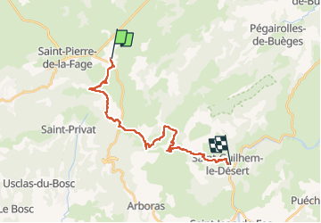

Length
22 km

Max alt
840 m

Uphill gradient
469 m
Km-Effort
30 km

Min alt
102 m

Downhill gradient
988 m
Boucle
No
Creation date :
2022-05-12 07:35:47.627
Updated on :
2022-05-12 17:36:55.595
10h00
Difficulty : Difficult

FREE GPS app for hiking
 SityTrail
IGN / Geographical institutes
SityTrail Plus
The world is yours!
About
Trail Walking of 22 km to be discovered at Occitania, Hérault, La Vacquerie-et-Saint-Martin-de-Castries. This trail is proposed by kephas.
Description
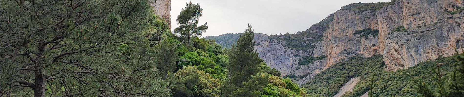
chemin de St Guilhem avec variante
Photos


Positioning
Country:
France
Region :
Occitania
Department/Province :
Hérault
Municipality :
La Vacquerie-et-Saint-Martin-de-Castries
Location:
Unknown
Start:(Dec)
Start:(UTM)
536948 ; 4848986 (31T) N.
Comments